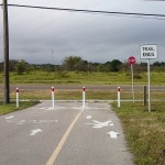
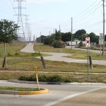
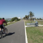
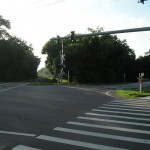
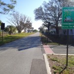
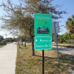
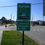
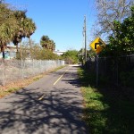
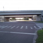
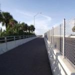
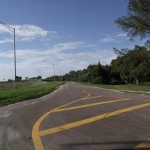
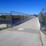
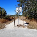
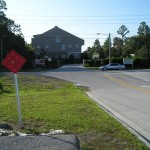
This trail is a mix of paved trail and on-road. Be aware, you will be sharing your ride space with other vehicular traffic during this route. I believe the trail will eventually be extended past its current end at Macoma Drive NE & 83rd Avenue NE. From that point, exercise caution; there is very little shoulder and it is a narrow two lane road once you approach the bridge near Riviera Bay.
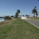
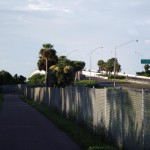
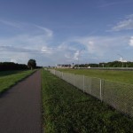
As seems to be the case with many of the trails in St. Petersburg, there isn’t much shade along this trail.
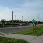
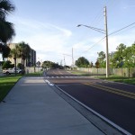
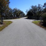
This is not a paved trail but, rather, on road with a dedicated bike lane. You will be sharing the roadway with vehicular traffic.
The trail does not have much in the way of shade so, if doing this trail during the heat of the day, sunscreen, sunglasses and a water bottle or two are strongly recommended.
Getting There:
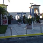
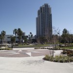
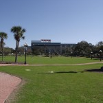
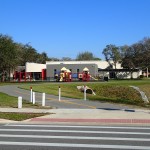
The starting point for this trail is the North Shore Swimming Pool parking lot in downtown St. Petersburg. Your best bet is to zoom in on the map below to be your bearings. Zooming out will give you a bigger picture on how to arrive in downtown St. Petersburg. Continue reading Island Loop Bike Route, St. Petersburg, Pinellas County, Florida
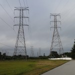
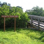
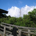
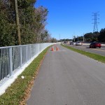
This is, other than the bridge to nowhere further north, the only section of the Progress Energy Trail. I have read that there is finally some news on extending the trail, there is budgeting for extending the trail to the north in the 2014 budget.
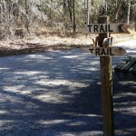
There is no shade along the trail proper. There is shade at the beginning of the trail that is part of the Ream Wilson Trail. Sunscreen and sunglasses are highly recommended during the afternoon hours.
Getting There:
The starting point of this trail is the same point I started on the Ream Wilson Trail. The link to the post is Ream Wilson Trail Recap.
Trail Length:
This loop is only 7.18 miles. Five miles of the trail is comprised of the Progress Energy Trail. It is about 1.1 miles from the Long Center to the intersection with the Progress Energy trail.
The Trail:
The trailbed is in decent shape. It is nice that they didn’t make the trail arrow straight but, rather, built some curves into the design.
The trail, being so short, can be turned into a longer ride by adding the Ream Wilson Trail (link is above).
Facilities:
There are facilities at Long Center at the start of the trail.
The Cons:
The length of the trail; too short.
There are some very busy streets to cross. Mainly the crossing at Highway 60. Be careful!
The Pros:
The curves built into the design.
Easy access to the Ream Wilson Trail.
The electrical easement is wide enough that there are opportunities to view minor wildlife along the trail.
Warning: Use of undefined constant name - assumed 'name' (this will throw an Error in a future version of PHP) in /home/viewfr7/public_html/wp-content/plugins/osm/osm_map/osm-oljs2.php on line 751
Warning: Use of undefined constant width - assumed 'width' (this will throw an Error in a future version of PHP) in /home/viewfr7/public_html/wp-content/plugins/osm/osm_map/osm-oljs2.php on line 751
Warning: Use of undefined constant height - assumed 'height' (this will throw an Error in a future version of PHP) in /home/viewfr7/public_html/wp-content/plugins/osm/osm_map/osm-oljs2.php on line 751
Warning: Use of undefined constant offset_width - assumed 'offset_width' (this will throw an Error in a future version of PHP) in /home/viewfr7/public_html/wp-content/plugins/osm/osm_map/osm-oljs2.php on line 751
Warning: Use of undefined constant offset_height - assumed 'offset_height' (this will throw an Error in a future version of PHP) in /home/viewfr7/public_html/wp-content/plugins/osm/osm_map/osm-oljs2.php on line 751
Warning: Use of undefined constant Marker - assumed 'Marker' (this will throw an Error in a future version of PHP) in /home/viewfr7/public_html/wp-content/plugins/osm/osm_map/osm-oljs2.php on line 782
Warning: Use of undefined constant name - assumed 'name' (this will throw an Error in a future version of PHP) in /home/viewfr7/public_html/wp-content/plugins/osm/osm_map/osm-oljs2.php on line 794
Warning: Use of undefined constant width - assumed 'width' (this will throw an Error in a future version of PHP) in /home/viewfr7/public_html/wp-content/plugins/osm/osm_map/osm-oljs2.php on line 798
Warning: Use of undefined constant height - assumed 'height' (this will throw an Error in a future version of PHP) in /home/viewfr7/public_html/wp-content/plugins/osm/osm_map/osm-oljs2.php on line 798
Warning: Use of undefined constant offset_width - assumed 'offset_width' (this will throw an Error in a future version of PHP) in /home/viewfr7/public_html/wp-content/plugins/osm/osm_map/osm-oljs2.php on line 799
Warning: Use of undefined constant offset_height - assumed 'offset_height' (this will throw an Error in a future version of PHP) in /home/viewfr7/public_html/wp-content/plugins/osm/osm_map/osm-oljs2.php on line 799
Warning: Use of undefined constant text - assumed 'text' (this will throw an Error in a future version of PHP) in /home/viewfr7/public_html/wp-content/plugins/osm/osm_map/osm-oljs2.php on line 807
Warning: Use of undefined constant lon - assumed 'lon' (this will throw an Error in a future version of PHP) in /home/viewfr7/public_html/wp-content/plugins/osm/osm_map/osm-oljs2.php on line 809
Warning: Use of undefined constant lat - assumed 'lat' (this will throw an Error in a future version of PHP) in /home/viewfr7/public_html/wp-content/plugins/osm/osm_map/osm-oljs2.php on line 809
Warning: Use of undefined constant popup_width - assumed 'popup_width' (this will throw an Error in a future version of PHP) in /home/viewfr7/public_html/wp-content/plugins/osm/osm_map/osm-oljs2.php on line 813
Warning: Use of undefined constant popup_height - assumed 'popup_height' (this will throw an Error in a future version of PHP) in /home/viewfr7/public_html/wp-content/plugins/osm/osm_map/osm-oljs2.php on line 813
Before You Go:
There is no shade along this trail so wear sunscreen. You can burn even in the winter months on a clear Florida day.
Getting There:
I began my ride at Weaver Park in Dunedin. From U.S. Highway 19 (approaching from the north or south), head west on Main street (County Road 580) toward the Gulf of Mexico. Around Bass Boulevard, Main Street will branch off and head toward the south and west. Stay on County Road 580 which becomes Skinner Boulevard. Where Skinner Boulevard intersects Broadway (County Road 595/Alternate Highway 19), head north on Broadway. Weaver Park will be on your left – there is parking on either side of Alt. 19.
Trail Length
15.88 Miles – From Weaver Park parking on the west side of Alternate Highway 19 south through Dunedin through north Clearwater. Through downtown Clearwater to the Clearwater Memorial Causeway Bridge. Out to Clearwater Beach and heading back to the point of origin.
The Trail
Check out the links and gallery pictures below.
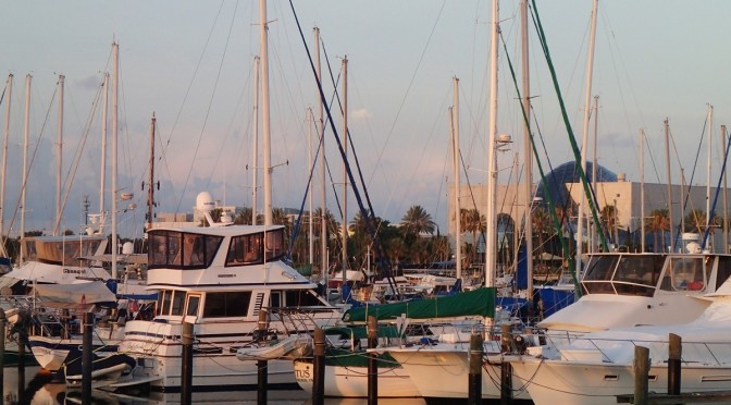
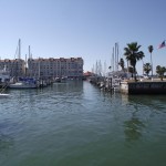
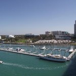
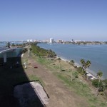
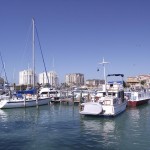
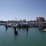
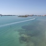
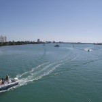
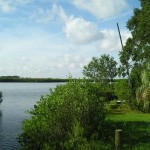
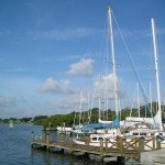
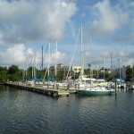
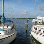
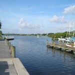
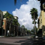
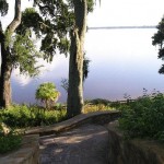
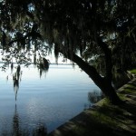
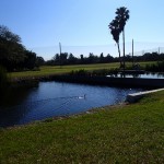
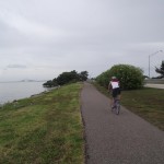
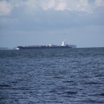
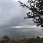
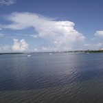
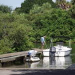
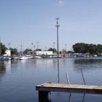
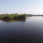
If you like being near the water, you will love this ride. It starts at JC Weaver Park just north of downtown Dunedin. You head south to the Dunedin Marina with its fine views of Old Clearwater Bay. Continuing south, you will meander between the shores of Old Clearwater Bay to your west and Edgewater Drive to your east.
Once you cross the bridge at the southern terminus of the Edgewater Trail, Edgewater Drive becomes North Fort Harrison Avenue and you have entered the city of Clearwater. Continue south along Fort Harrison (you will be sharing the roadway with automobiles) and head west on Seminole Street. If you want to make a small detour, there is a marina in the process of being renovated at the western end of Seminole Street.
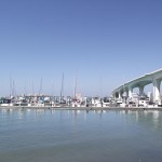
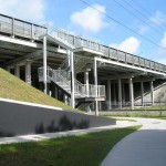
Head south on North Osceola Avenue, west on Jones Street and then south where Osceola Avenue picks up again. From there, head west on Drew Street which curves to the south to follow the waterfront. There is a trail that runs parallel to Drew Street and crosses under the Clearwater Memorial Causeway bridge.
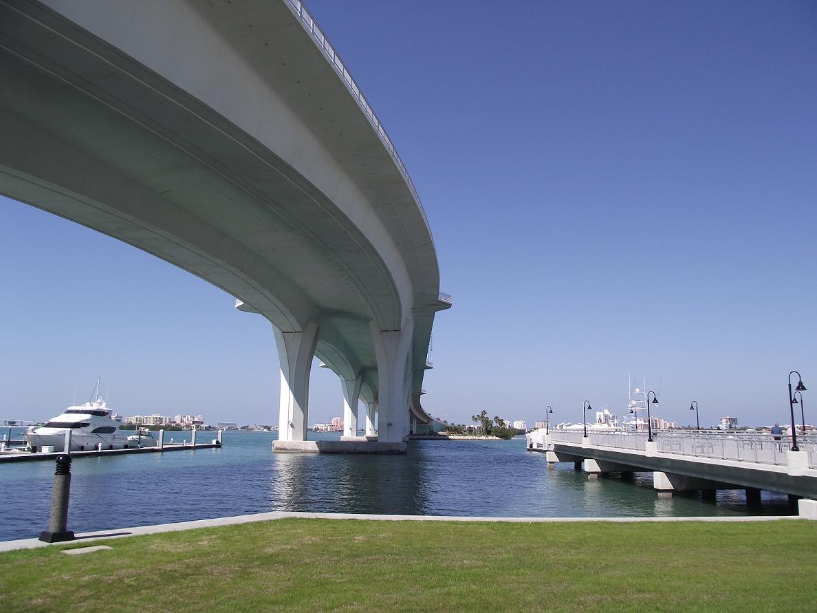
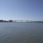
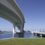
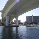
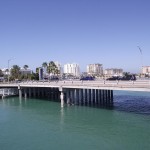
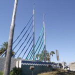
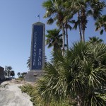
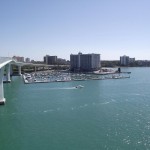
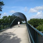
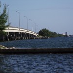
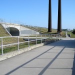
You will see a spiral ramp that leads up to the Clearwater Memorial Causeway Bridge. A pedestrian/bike trail parallels the bridge on both sides. I would suggest the side connected to the spiral ramp. At certain times of year (spring break comes to mind), it is almost impossible to cross the Causeway. So, the spiral ramp keeps you from the headache of later having to cross congested Clearwater Memorial Causeway.
Be sure to stop at the top of the bridge to see the fine views of the intercoastal and downtown Clearwater. It is an easy ride out to Clearwater Beach from the top of the Causeway Bridge. There are plenty of things to see and do in Clearwater Beach. Check out the link below for more information.
Facilities:
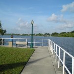
There are facilities at Edgewater Park which fronts along the Dunedin Marina
The Cons:
This route features sections where there is no designated trail. You will be sharing the road with other vehicles.
If you aren’t in the greatest shape, the climb up the Clearwater Memorial Causeway Bridge could be taxing.
The congestion of foot traffic and, traffic in general, around Clearwater Beach.
The Pros:
The scenery.
The Dunedin Marina.
If you are in good shape, the climb up the Clearwater Memorial Causeway Bridge. 🙂
The Clearwater Memorial Causeway Bridge – my love for bridges continues!
Warning: Use of undefined constant name - assumed 'name' (this will throw an Error in a future version of PHP) in /home/viewfr7/public_html/wp-content/plugins/osm/osm_map/osm-oljs2.php on line 751
Warning: Use of undefined constant width - assumed 'width' (this will throw an Error in a future version of PHP) in /home/viewfr7/public_html/wp-content/plugins/osm/osm_map/osm-oljs2.php on line 751
Warning: Use of undefined constant height - assumed 'height' (this will throw an Error in a future version of PHP) in /home/viewfr7/public_html/wp-content/plugins/osm/osm_map/osm-oljs2.php on line 751
Warning: Use of undefined constant offset_width - assumed 'offset_width' (this will throw an Error in a future version of PHP) in /home/viewfr7/public_html/wp-content/plugins/osm/osm_map/osm-oljs2.php on line 751
Warning: Use of undefined constant offset_height - assumed 'offset_height' (this will throw an Error in a future version of PHP) in /home/viewfr7/public_html/wp-content/plugins/osm/osm_map/osm-oljs2.php on line 751
Warning: Use of undefined constant Marker - assumed 'Marker' (this will throw an Error in a future version of PHP) in /home/viewfr7/public_html/wp-content/plugins/osm/osm_map/osm-oljs2.php on line 782
Warning: Use of undefined constant name - assumed 'name' (this will throw an Error in a future version of PHP) in /home/viewfr7/public_html/wp-content/plugins/osm/osm_map/osm-oljs2.php on line 794
Warning: Use of undefined constant width - assumed 'width' (this will throw an Error in a future version of PHP) in /home/viewfr7/public_html/wp-content/plugins/osm/osm_map/osm-oljs2.php on line 798
Warning: Use of undefined constant height - assumed 'height' (this will throw an Error in a future version of PHP) in /home/viewfr7/public_html/wp-content/plugins/osm/osm_map/osm-oljs2.php on line 798
Warning: Use of undefined constant offset_width - assumed 'offset_width' (this will throw an Error in a future version of PHP) in /home/viewfr7/public_html/wp-content/plugins/osm/osm_map/osm-oljs2.php on line 799
Warning: Use of undefined constant offset_height - assumed 'offset_height' (this will throw an Error in a future version of PHP) in /home/viewfr7/public_html/wp-content/plugins/osm/osm_map/osm-oljs2.php on line 799
Warning: Use of undefined constant text - assumed 'text' (this will throw an Error in a future version of PHP) in /home/viewfr7/public_html/wp-content/plugins/osm/osm_map/osm-oljs2.php on line 807
Warning: Use of undefined constant lon - assumed 'lon' (this will throw an Error in a future version of PHP) in /home/viewfr7/public_html/wp-content/plugins/osm/osm_map/osm-oljs2.php on line 809
Warning: Use of undefined constant lat - assumed 'lat' (this will throw an Error in a future version of PHP) in /home/viewfr7/public_html/wp-content/plugins/osm/osm_map/osm-oljs2.php on line 809
Warning: Use of undefined constant popup_width - assumed 'popup_width' (this will throw an Error in a future version of PHP) in /home/viewfr7/public_html/wp-content/plugins/osm/osm_map/osm-oljs2.php on line 813
Warning: Use of undefined constant popup_height - assumed 'popup_height' (this will throw an Error in a future version of PHP) in /home/viewfr7/public_html/wp-content/plugins/osm/osm_map/osm-oljs2.php on line 813
Before You Go:
The trail is a mix of shaded and open space but is relatively short. If you make this a part of the longer Ream Wilson Trail ride from Long Center to Philippe Park, then you will need sunscreen, sunglasses and the usual helmet and cycling gloves.
Getting There:
The easiest way to get to the Kapok Park Extension is to access it off the Ream Wilson Trail. If that is your plan, here is the link to my Ream Wilson Trail Recap (look for the “Getting There” section).
If you just want to explore this area, the easiest access to the trail is the Glen Oak Avenue Trailhead. From the south, head north on McMullen Booth Road (County Road 611). Turn west onto Terrace View Lane. Terrace View Lane ends at Moss Avenue. Turn north onto Moss Avenue which, in turn, ends at Glen Oak Avenue. Turn west onto Glen Oak Avenue. The street dead ends at the trailhead. Use the map below to zoom in and out to get your bearings.)
Trail Length
1.92 Miles – From the Glen Oak Avenue trailhead out to Stephens Park to the crossing at the main Ream Wilson Trail and back to the Glen Oak Avenue trailhead.
The Trail
Facilities:
There were no facilities
The Cons:
Nothing of note. The shortness of the trail but that can be remedied by adding this short ride as a sidetrip off the longer main trail (link noted above)
The Pros:
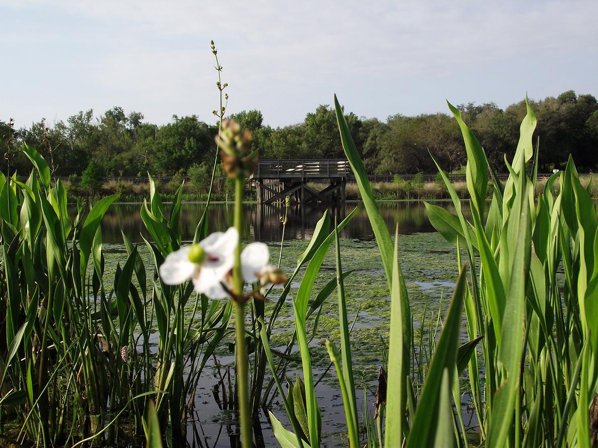
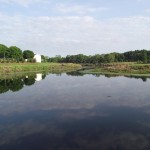
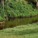
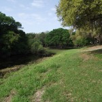
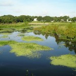
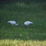
The scenery.
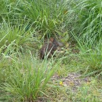
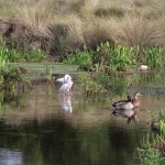
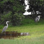
The wildlife.
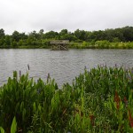
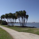
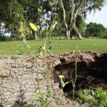
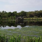
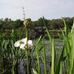
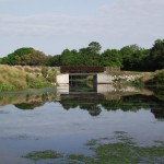
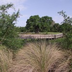
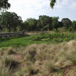
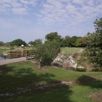
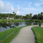
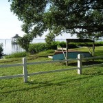
As stated elsewhere, this is a small side trip off the main Ream Wilson Trail. It is worth the stop to take in the beautiful surroundings of this lovely preserved area. From what I’ve read, this used to be home to a mobile home park but the city of Clearwater redeveloped the area as a flood control project. Well done!
Warning: Use of undefined constant name - assumed 'name' (this will throw an Error in a future version of PHP) in /home/viewfr7/public_html/wp-content/plugins/osm/osm_map/osm-oljs2.php on line 751
Warning: Use of undefined constant width - assumed 'width' (this will throw an Error in a future version of PHP) in /home/viewfr7/public_html/wp-content/plugins/osm/osm_map/osm-oljs2.php on line 751
Warning: Use of undefined constant height - assumed 'height' (this will throw an Error in a future version of PHP) in /home/viewfr7/public_html/wp-content/plugins/osm/osm_map/osm-oljs2.php on line 751
Warning: Use of undefined constant offset_width - assumed 'offset_width' (this will throw an Error in a future version of PHP) in /home/viewfr7/public_html/wp-content/plugins/osm/osm_map/osm-oljs2.php on line 751
Warning: Use of undefined constant offset_height - assumed 'offset_height' (this will throw an Error in a future version of PHP) in /home/viewfr7/public_html/wp-content/plugins/osm/osm_map/osm-oljs2.php on line 751
Warning: Use of undefined constant Marker - assumed 'Marker' (this will throw an Error in a future version of PHP) in /home/viewfr7/public_html/wp-content/plugins/osm/osm_map/osm-oljs2.php on line 782
Warning: Use of undefined constant name - assumed 'name' (this will throw an Error in a future version of PHP) in /home/viewfr7/public_html/wp-content/plugins/osm/osm_map/osm-oljs2.php on line 794
Warning: Use of undefined constant width - assumed 'width' (this will throw an Error in a future version of PHP) in /home/viewfr7/public_html/wp-content/plugins/osm/osm_map/osm-oljs2.php on line 798
Warning: Use of undefined constant height - assumed 'height' (this will throw an Error in a future version of PHP) in /home/viewfr7/public_html/wp-content/plugins/osm/osm_map/osm-oljs2.php on line 798
Warning: Use of undefined constant offset_width - assumed 'offset_width' (this will throw an Error in a future version of PHP) in /home/viewfr7/public_html/wp-content/plugins/osm/osm_map/osm-oljs2.php on line 799
Warning: Use of undefined constant offset_height - assumed 'offset_height' (this will throw an Error in a future version of PHP) in /home/viewfr7/public_html/wp-content/plugins/osm/osm_map/osm-oljs2.php on line 799
Warning: Use of undefined constant text - assumed 'text' (this will throw an Error in a future version of PHP) in /home/viewfr7/public_html/wp-content/plugins/osm/osm_map/osm-oljs2.php on line 807
Warning: Use of undefined constant lon - assumed 'lon' (this will throw an Error in a future version of PHP) in /home/viewfr7/public_html/wp-content/plugins/osm/osm_map/osm-oljs2.php on line 809
Warning: Use of undefined constant lat - assumed 'lat' (this will throw an Error in a future version of PHP) in /home/viewfr7/public_html/wp-content/plugins/osm/osm_map/osm-oljs2.php on line 809
Warning: Use of undefined constant popup_width - assumed 'popup_width' (this will throw an Error in a future version of PHP) in /home/viewfr7/public_html/wp-content/plugins/osm/osm_map/osm-oljs2.php on line 813
Warning: Use of undefined constant popup_height - assumed 'popup_height' (this will throw an Error in a future version of PHP) in /home/viewfr7/public_html/wp-content/plugins/osm/osm_map/osm-oljs2.php on line 813
Before You Go:
The trail is a mix of shaded and open space. It only takes 20 minutes of direct sun to get a nice sunburn in Florida. Sunscreen is recommended for the fair of skin. Always recommended – helmet, pair of good sunglasses and cushioned gloves.
Getting There:
The starting point for this ride was Long Center in Clearwater located at 1501 North Belcher Road, Clearwater, FL 33765. It is easily accessible from U.S. Highway 19 approaching from either the north or south. From the north, head west on Sunset Point Road and then south on Belcher. From the south, head southwesterly on NE Coachman Road and turn north onto Belcher Road. Long Center sits about 1/2 way between these two major roads. It is on the east side of Belcher Road and there is ample parking on the weekends.
Trail Length
15.5 Miles – from Long Center east and north along the Ream Wilson Trail then north along the Bayshore Linear Greenspace in Palm Harbor. Turning about in Philippe Park to return to the point of origin.
The Trail
Facilities:
There are facilities in Long Center
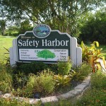
There are facilities at the Safety Harbor Marina
There are facilities within Philippe Park
The Cons:
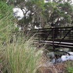
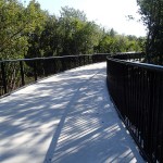
There are a few sections where the trail width is very narrow especially some of the bridges along the western portion of the trail.
There is a 10% grade hill around the entrance to Kapok Park.
The Pros:
The scenery in the western portion is heavily wooded and crosses several streams.
This isn’t a straight arrow trail. There is a fair amount of twists and turns along the western portion of the trail.
The 10% grade hill that I mentioned as a con above 🙂
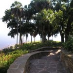
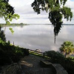
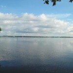
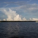
The views of Old Tampa Bay along the eastern end of the trail as you turn north.
Safety Harbor Marina is a perfect rest stop.
This is one of my favorite rides in Pinellas County. You ride through a variety of ecosystems and the trail has enough turns to keep it interesting. If you have the time, a side trip through Kapok Park is worth the time and effort.
Warning: Use of undefined constant name - assumed 'name' (this will throw an Error in a future version of PHP) in /home/viewfr7/public_html/wp-content/plugins/osm/osm_map/osm-oljs2.php on line 751
Warning: Use of undefined constant width - assumed 'width' (this will throw an Error in a future version of PHP) in /home/viewfr7/public_html/wp-content/plugins/osm/osm_map/osm-oljs2.php on line 751
Warning: Use of undefined constant height - assumed 'height' (this will throw an Error in a future version of PHP) in /home/viewfr7/public_html/wp-content/plugins/osm/osm_map/osm-oljs2.php on line 751
Warning: Use of undefined constant offset_width - assumed 'offset_width' (this will throw an Error in a future version of PHP) in /home/viewfr7/public_html/wp-content/plugins/osm/osm_map/osm-oljs2.php on line 751
Warning: Use of undefined constant offset_height - assumed 'offset_height' (this will throw an Error in a future version of PHP) in /home/viewfr7/public_html/wp-content/plugins/osm/osm_map/osm-oljs2.php on line 751
Warning: Use of undefined constant Marker - assumed 'Marker' (this will throw an Error in a future version of PHP) in /home/viewfr7/public_html/wp-content/plugins/osm/osm_map/osm-oljs2.php on line 782
Warning: Use of undefined constant name - assumed 'name' (this will throw an Error in a future version of PHP) in /home/viewfr7/public_html/wp-content/plugins/osm/osm_map/osm-oljs2.php on line 794
Warning: Use of undefined constant width - assumed 'width' (this will throw an Error in a future version of PHP) in /home/viewfr7/public_html/wp-content/plugins/osm/osm_map/osm-oljs2.php on line 798
Warning: Use of undefined constant height - assumed 'height' (this will throw an Error in a future version of PHP) in /home/viewfr7/public_html/wp-content/plugins/osm/osm_map/osm-oljs2.php on line 798
Warning: Use of undefined constant offset_width - assumed 'offset_width' (this will throw an Error in a future version of PHP) in /home/viewfr7/public_html/wp-content/plugins/osm/osm_map/osm-oljs2.php on line 799
Warning: Use of undefined constant offset_height - assumed 'offset_height' (this will throw an Error in a future version of PHP) in /home/viewfr7/public_html/wp-content/plugins/osm/osm_map/osm-oljs2.php on line 799
Warning: Use of undefined constant text - assumed 'text' (this will throw an Error in a future version of PHP) in /home/viewfr7/public_html/wp-content/plugins/osm/osm_map/osm-oljs2.php on line 807
Warning: Use of undefined constant lon - assumed 'lon' (this will throw an Error in a future version of PHP) in /home/viewfr7/public_html/wp-content/plugins/osm/osm_map/osm-oljs2.php on line 809
Warning: Use of undefined constant lat - assumed 'lat' (this will throw an Error in a future version of PHP) in /home/viewfr7/public_html/wp-content/plugins/osm/osm_map/osm-oljs2.php on line 809
Warning: Use of undefined constant popup_width - assumed 'popup_width' (this will throw an Error in a future version of PHP) in /home/viewfr7/public_html/wp-content/plugins/osm/osm_map/osm-oljs2.php on line 813
Warning: Use of undefined constant popup_height - assumed 'popup_height' (this will throw an Error in a future version of PHP) in /home/viewfr7/public_html/wp-content/plugins/osm/osm_map/osm-oljs2.php on line 813
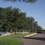
Before You Go:
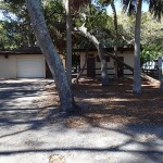
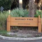
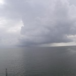
Except for the start of this trail at Maximo Park, there is no shade along this course. Bring along sunglasses, sunscreen, a helmet and gloves. And, during the rainy months, keep your eye to the sky since the weather can deteriorate rapidly. Insect repellant is also recommended during the rainy season since part of this ride is through the Clam Bayou wetlands.
Getting There:
I began this ride at Maximo Park which is just a bit west of where the southern portion of the Skyway Trail used to end. To reach Maximo Park, take the Pinellas Point Drive exit off I-275/U.S. Hwy 19 North and head west. You will pass under I-275/U.S. Hwy 19 North and the park entrance is just after the underpass.
Trail Length
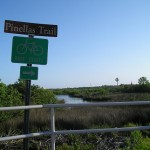
12 Miles – from Maximo Park all the way out to the trail-end where it intersects the Pinellas Trail and back. If you ride the bicycle trail in Maximo Park and along the permeter roads within the park, the ride will be just a tad over 13 miles.
The Trail
Facilities:
There are facilities in Maximo Park.
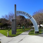
While I didn’t not see them, I sure there are facilities at the Childs Park recreation center.
The Cons:
There is virtually no signage along the southern portion of the trail where the Skyway Trail used to end at Pinellas Point Drive and Skyway Lane.
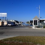
There is no dedicated trail space from Pinellas Point Drive until you reach Loggerhead Marina.
It is an urban trail so there are quite a few street crossings near the beginning and turnaround portions of the trail.
If you ride the bike trail in Maximo Park, the southern end of the trail is in rough shape.
The crossing at 22nd Avenue South – use extreme caution. There is a user activated crossing signal but, the morning I rode through the intersection, some vehicles showed reluctance to stop for the flashing crosswalk signals.
The Pros:
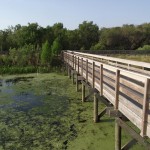
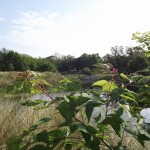
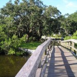
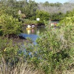
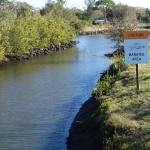
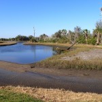
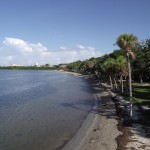
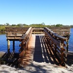
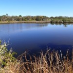
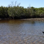
The section through Clam Bayou is beautiful.
Lots of elevated trailways and bridges spanning Clam Bayou. It is a nice serpentine course through the bayou.
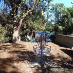
The disc golf course in Maximo Park is fun.
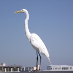
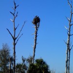
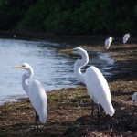
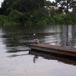
Lots of opportunities for bird watching along the trail. I could hear baby eagles in a nest (picture in the gallery below) and watched their parents tending the eaglettes.
I was disappointed that there was no guidance in linking the old trail end to the newer section. If you are going to have us share the road with automobiles, at least do us the courtesy of placing some signs directing us to the least traveled course to link up the two trails. I missed the turnoff that would have saved me a lot of drama crossing the off ramps on I-275 that empty onto 54th Avenue South and having to travel along 54th Avenue South. For those of you unfamiliar with the area, that is one busy street!
To help avoid this issue for those of you, like me, need some guidance; here is the path from the intersection of Skyway Lane and Pinellas Point Drive South (the old nothern end of the southern section of the trail):
Head east along Pinellas Point Drive South.
Turn north onto 31st Street South.
Turn west onto 58th Avenue South.
You will see a large marina on the south side of 58th Avenue South.
On the west side of the marina, you will see a dedicated trail – follow it around under I-275/U.S. Hwy 19 North.
You will reach a large intersection. Cross to the north side and head west along 54th Avenue South.
Turn north behind the CVS Pharmacy and continue to enjoy your trip north!
The trail through Clam Bayou is a highlight of this ride. The Cities of St. Petersburg & Gulfport did an excellent job. All in all, a very nice ride!!
Warning: Use of undefined constant name - assumed 'name' (this will throw an Error in a future version of PHP) in /home/viewfr7/public_html/wp-content/plugins/osm/osm_map/osm-oljs2.php on line 751
Warning: Use of undefined constant width - assumed 'width' (this will throw an Error in a future version of PHP) in /home/viewfr7/public_html/wp-content/plugins/osm/osm_map/osm-oljs2.php on line 751
Warning: Use of undefined constant height - assumed 'height' (this will throw an Error in a future version of PHP) in /home/viewfr7/public_html/wp-content/plugins/osm/osm_map/osm-oljs2.php on line 751
Warning: Use of undefined constant offset_width - assumed 'offset_width' (this will throw an Error in a future version of PHP) in /home/viewfr7/public_html/wp-content/plugins/osm/osm_map/osm-oljs2.php on line 751
Warning: Use of undefined constant offset_height - assumed 'offset_height' (this will throw an Error in a future version of PHP) in /home/viewfr7/public_html/wp-content/plugins/osm/osm_map/osm-oljs2.php on line 751
Warning: Use of undefined constant Marker - assumed 'Marker' (this will throw an Error in a future version of PHP) in /home/viewfr7/public_html/wp-content/plugins/osm/osm_map/osm-oljs2.php on line 782
Warning: Use of undefined constant name - assumed 'name' (this will throw an Error in a future version of PHP) in /home/viewfr7/public_html/wp-content/plugins/osm/osm_map/osm-oljs2.php on line 794
Warning: Use of undefined constant width - assumed 'width' (this will throw an Error in a future version of PHP) in /home/viewfr7/public_html/wp-content/plugins/osm/osm_map/osm-oljs2.php on line 798
Warning: Use of undefined constant height - assumed 'height' (this will throw an Error in a future version of PHP) in /home/viewfr7/public_html/wp-content/plugins/osm/osm_map/osm-oljs2.php on line 798
Warning: Use of undefined constant offset_width - assumed 'offset_width' (this will throw an Error in a future version of PHP) in /home/viewfr7/public_html/wp-content/plugins/osm/osm_map/osm-oljs2.php on line 799
Warning: Use of undefined constant offset_height - assumed 'offset_height' (this will throw an Error in a future version of PHP) in /home/viewfr7/public_html/wp-content/plugins/osm/osm_map/osm-oljs2.php on line 799
Warning: Use of undefined constant text - assumed 'text' (this will throw an Error in a future version of PHP) in /home/viewfr7/public_html/wp-content/plugins/osm/osm_map/osm-oljs2.php on line 807
Warning: Use of undefined constant lon - assumed 'lon' (this will throw an Error in a future version of PHP) in /home/viewfr7/public_html/wp-content/plugins/osm/osm_map/osm-oljs2.php on line 809
Warning: Use of undefined constant lat - assumed 'lat' (this will throw an Error in a future version of PHP) in /home/viewfr7/public_html/wp-content/plugins/osm/osm_map/osm-oljs2.php on line 809
Warning: Use of undefined constant popup_width - assumed 'popup_width' (this will throw an Error in a future version of PHP) in /home/viewfr7/public_html/wp-content/plugins/osm/osm_map/osm-oljs2.php on line 813
Warning: Use of undefined constant popup_height - assumed 'popup_height' (this will throw an Error in a future version of PHP) in /home/viewfr7/public_html/wp-content/plugins/osm/osm_map/osm-oljs2.php on line 813
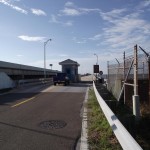
Before You Go:
Except for the start of this trail at Maximo Park, there is no shade along this course. Bring along sunglasses, sunscreen, a helmet and gloves. And, during the rainy months, keep your eye to the sky since the weather can deteriorate rapidly.
Getting There:
Maximo Park is very near the trail and, currently, there is no charge to park. It is located in southwestern St. Petersburg. If you head south on Interstate 275, it is the last exit before you have to pay the toll. Just follow the signs to the park entrance.
Trail Length
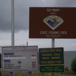
11.3 Miles – from Maximo Park all the way out to the North Skyway Fishing Pier and back. If you ride around Maximo Park, it ends up just sky of 12 miles.
The Trail
Facilities:
There are facilities in Maximo Park.
There are facilities at the North Sunshine Skyway Rest Area (north of the North Skyway Fishing Pier).
The Cons:
There are really no cons for this ride but, to be picky – it is too short a ride! Though, I’ve read that they’ve built an extension that I hope to ride this weekend (super excited) 🙂
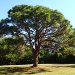
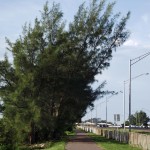
As you head south along the trail, look for a stand of Australian Pines lining the trail. The roots have grown under the trail and the ride is quite rough through this section.
The constant whir of traffic as you parallel Interstate 275/U.S. Highway 19.
The Pros:
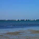
Gorgeous views of Tampa Bay.
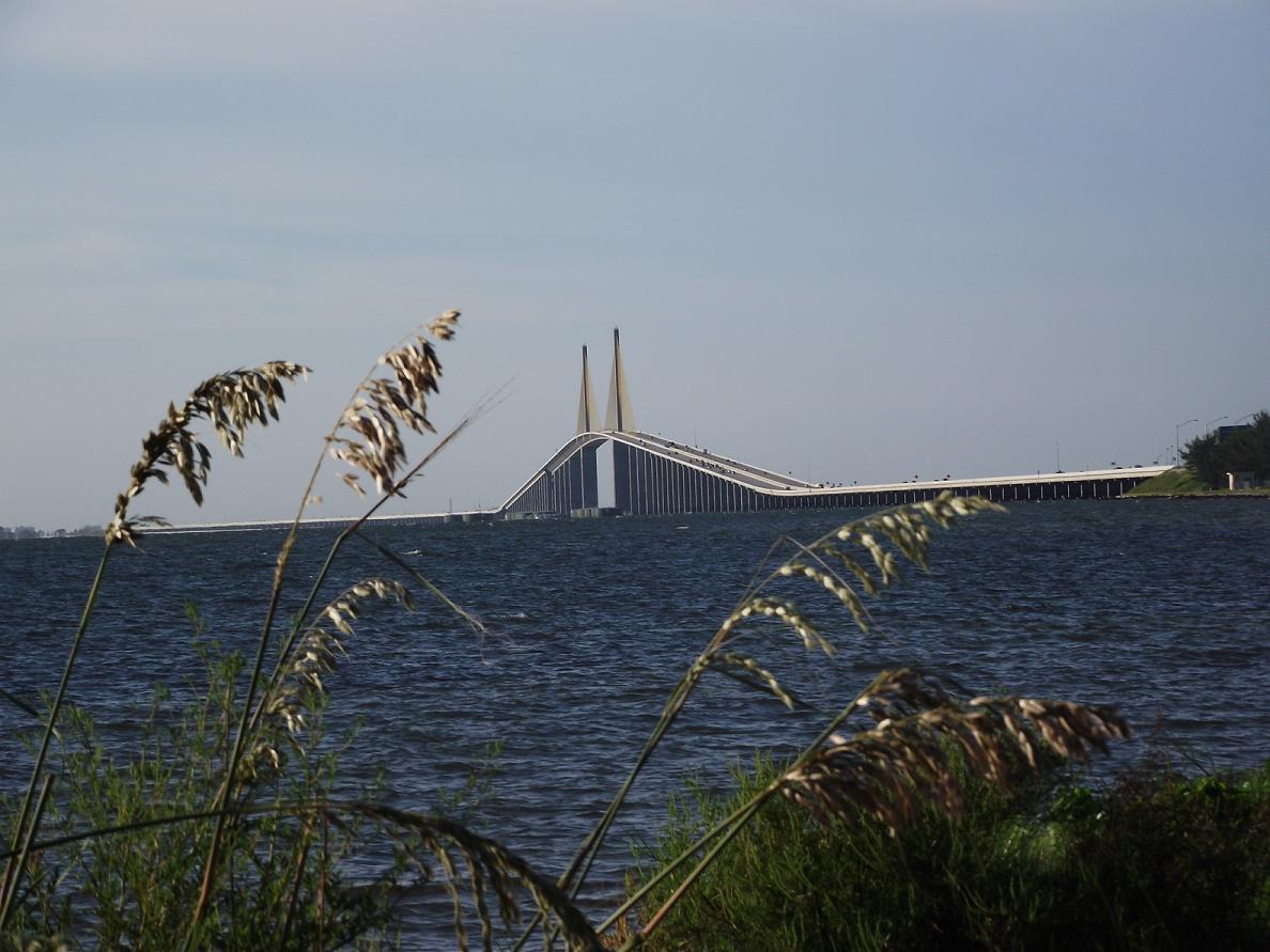
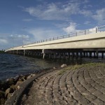
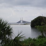
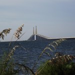
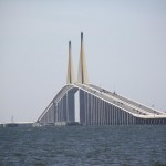
The bridges (I love bridges)! The Grand Dame of bridges in Florida – the Sunshine Skyway Bridge. A jeweled neckless that spans the throat of Tampa Bay.
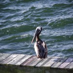
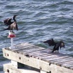
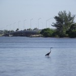
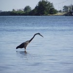
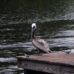
Diving Pelicans, Comorrants spreading their wings, heron and egrets fishing – the birds throughout this trail are abundant.
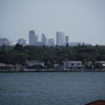
This is one of the most beautiful rides in all of Pinellas County. Breath taking views, abundant wildlife and the nice little climb up and over the Dick Misener Bridge. Awesome views of the Sunshine Skyway Bridge await the rider on the way south while you can see the distant St. Petersburg skyline on the return trip.
Warning: Use of undefined constant name - assumed 'name' (this will throw an Error in a future version of PHP) in /home/viewfr7/public_html/wp-content/plugins/osm/osm_map/osm-oljs2.php on line 751
Warning: Use of undefined constant width - assumed 'width' (this will throw an Error in a future version of PHP) in /home/viewfr7/public_html/wp-content/plugins/osm/osm_map/osm-oljs2.php on line 751
Warning: Use of undefined constant height - assumed 'height' (this will throw an Error in a future version of PHP) in /home/viewfr7/public_html/wp-content/plugins/osm/osm_map/osm-oljs2.php on line 751
Warning: Use of undefined constant offset_width - assumed 'offset_width' (this will throw an Error in a future version of PHP) in /home/viewfr7/public_html/wp-content/plugins/osm/osm_map/osm-oljs2.php on line 751
Warning: Use of undefined constant offset_height - assumed 'offset_height' (this will throw an Error in a future version of PHP) in /home/viewfr7/public_html/wp-content/plugins/osm/osm_map/osm-oljs2.php on line 751
Warning: Use of undefined constant Marker - assumed 'Marker' (this will throw an Error in a future version of PHP) in /home/viewfr7/public_html/wp-content/plugins/osm/osm_map/osm-oljs2.php on line 782
Warning: Use of undefined constant name - assumed 'name' (this will throw an Error in a future version of PHP) in /home/viewfr7/public_html/wp-content/plugins/osm/osm_map/osm-oljs2.php on line 794
Warning: Use of undefined constant width - assumed 'width' (this will throw an Error in a future version of PHP) in /home/viewfr7/public_html/wp-content/plugins/osm/osm_map/osm-oljs2.php on line 798
Warning: Use of undefined constant height - assumed 'height' (this will throw an Error in a future version of PHP) in /home/viewfr7/public_html/wp-content/plugins/osm/osm_map/osm-oljs2.php on line 798
Warning: Use of undefined constant offset_width - assumed 'offset_width' (this will throw an Error in a future version of PHP) in /home/viewfr7/public_html/wp-content/plugins/osm/osm_map/osm-oljs2.php on line 799
Warning: Use of undefined constant offset_height - assumed 'offset_height' (this will throw an Error in a future version of PHP) in /home/viewfr7/public_html/wp-content/plugins/osm/osm_map/osm-oljs2.php on line 799
Warning: Use of undefined constant text - assumed 'text' (this will throw an Error in a future version of PHP) in /home/viewfr7/public_html/wp-content/plugins/osm/osm_map/osm-oljs2.php on line 807
Warning: Use of undefined constant lon - assumed 'lon' (this will throw an Error in a future version of PHP) in /home/viewfr7/public_html/wp-content/plugins/osm/osm_map/osm-oljs2.php on line 809
Warning: Use of undefined constant lat - assumed 'lat' (this will throw an Error in a future version of PHP) in /home/viewfr7/public_html/wp-content/plugins/osm/osm_map/osm-oljs2.php on line 809
Warning: Use of undefined constant popup_width - assumed 'popup_width' (this will throw an Error in a future version of PHP) in /home/viewfr7/public_html/wp-content/plugins/osm/osm_map/osm-oljs2.php on line 813
Warning: Use of undefined constant popup_height - assumed 'popup_height' (this will throw an Error in a future version of PHP) in /home/viewfr7/public_html/wp-content/plugins/osm/osm_map/osm-oljs2.php on line 813
Before You Go:
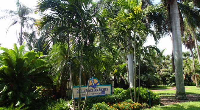
If you just tool around the park area, you shouldn’t require the normal Florida equipment. However, if planning to spend extended period of time in the park or adding to the length of the trail by biking the nearby Pinellas Trail, you should plan to have sunscreen, sunglasses and biking gloves. The North Anclote River does run through the park so insect repellant is probably advisable during the rainy summy months.
Getting There:
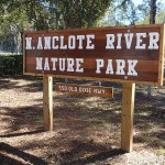
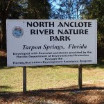
I actually rode to this park off the Pinellas Trail. The actual address of the park is 550 Old Dixie Highway, Tarpon Springs, FL. MapQuest would probably be a better way to locate the park from your location rather than me trying to describe how to get to the park entrance. Alternatively, you can zoom in on the map below to get an idea of the park’s location.
Trail Length
Biking just along the paths in the park is about 3 miltes (I came up with 2.88 miles but didn’t hit every trail). For the biker that needs a little more meat to their rides, I would suggest adding the park as a stop along the longer Pinellas Trail. There is access to the park directly off the Pinellas Trail.
The Trail
Facilities:
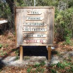
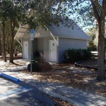
There are facilities at the main entrance to the park on Old Dixie Highway.
There are facilities in the southeast corner of the park near the Redfish Point overlook.
The Cons:
Except for the portion that comes in off the Pinellas Trail, the trails are not paved. The trailbed consists of crushed shell/limestone mix.
The length of the trail – too short. It would be nice to see the section that comes off the Pinellas Trail extended toward Tarpon Springs and, possibly, link up with the Sponge Docks.
The Pros:
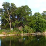
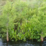
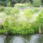
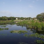
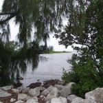
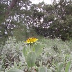
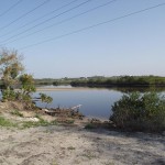
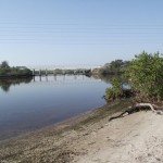
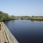
Nice views of the North Anclote River basin.
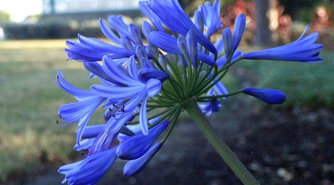
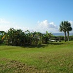
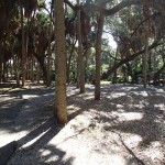
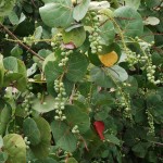
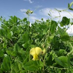
Lots of flora and fauna kept in a very natural state. The park is kept in a fairly natural state.
If you like minimal human intrusion, you will enjoy this park. As mentioned above, though, you will probably want to make this a stop as a part of a longer ride along the Pinellas Trail. Despite its small size, it is still well worth the extra time to spend wandering around the park.
Warning: Use of undefined constant name - assumed 'name' (this will throw an Error in a future version of PHP) in /home/viewfr7/public_html/wp-content/plugins/osm/osm_map/osm-oljs2.php on line 751
Warning: Use of undefined constant width - assumed 'width' (this will throw an Error in a future version of PHP) in /home/viewfr7/public_html/wp-content/plugins/osm/osm_map/osm-oljs2.php on line 751
Warning: Use of undefined constant height - assumed 'height' (this will throw an Error in a future version of PHP) in /home/viewfr7/public_html/wp-content/plugins/osm/osm_map/osm-oljs2.php on line 751
Warning: Use of undefined constant offset_width - assumed 'offset_width' (this will throw an Error in a future version of PHP) in /home/viewfr7/public_html/wp-content/plugins/osm/osm_map/osm-oljs2.php on line 751
Warning: Use of undefined constant offset_height - assumed 'offset_height' (this will throw an Error in a future version of PHP) in /home/viewfr7/public_html/wp-content/plugins/osm/osm_map/osm-oljs2.php on line 751
Warning: Use of undefined constant Marker - assumed 'Marker' (this will throw an Error in a future version of PHP) in /home/viewfr7/public_html/wp-content/plugins/osm/osm_map/osm-oljs2.php on line 782
Warning: Use of undefined constant name - assumed 'name' (this will throw an Error in a future version of PHP) in /home/viewfr7/public_html/wp-content/plugins/osm/osm_map/osm-oljs2.php on line 794
Warning: Use of undefined constant width - assumed 'width' (this will throw an Error in a future version of PHP) in /home/viewfr7/public_html/wp-content/plugins/osm/osm_map/osm-oljs2.php on line 798
Warning: Use of undefined constant height - assumed 'height' (this will throw an Error in a future version of PHP) in /home/viewfr7/public_html/wp-content/plugins/osm/osm_map/osm-oljs2.php on line 798
Warning: Use of undefined constant offset_width - assumed 'offset_width' (this will throw an Error in a future version of PHP) in /home/viewfr7/public_html/wp-content/plugins/osm/osm_map/osm-oljs2.php on line 799
Warning: Use of undefined constant offset_height - assumed 'offset_height' (this will throw an Error in a future version of PHP) in /home/viewfr7/public_html/wp-content/plugins/osm/osm_map/osm-oljs2.php on line 799
Warning: Use of undefined constant text - assumed 'text' (this will throw an Error in a future version of PHP) in /home/viewfr7/public_html/wp-content/plugins/osm/osm_map/osm-oljs2.php on line 807
Warning: Use of undefined constant lon - assumed 'lon' (this will throw an Error in a future version of PHP) in /home/viewfr7/public_html/wp-content/plugins/osm/osm_map/osm-oljs2.php on line 809
Warning: Use of undefined constant lat - assumed 'lat' (this will throw an Error in a future version of PHP) in /home/viewfr7/public_html/wp-content/plugins/osm/osm_map/osm-oljs2.php on line 809
Warning: Use of undefined constant popup_width - assumed 'popup_width' (this will throw an Error in a future version of PHP) in /home/viewfr7/public_html/wp-content/plugins/osm/osm_map/osm-oljs2.php on line 813
Warning: Use of undefined constant popup_height - assumed 'popup_height' (this will throw an Error in a future version of PHP) in /home/viewfr7/public_html/wp-content/plugins/osm/osm_map/osm-oljs2.php on line 813
Before You Go:
Normal Florida cycling gear is always recommended – a helmet, a good pair of sunglasses, sunscreen and a pair of cushioned cycling gloves. For this leg, if you do the side trek through Wall Springs Park, insect repellant is recommended.
Getting There:
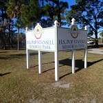
I began this leg at the H. S. “Pop” Stansell Memorial Park (ain’t that a mouth full) in Palm Harbor. The easiest way to get to the park is by heading either north or south (depending on your location) on U. S. Highway 19 and turning west on Tampa Road. From Tamp Road, continue west until you reach Palm Harbor Boulevard (also known as ALT US 19 & County Road 595). Head north on Palm Harbor Boulevard for approximately one mile and turn west onto Florida Avenue. Florida Avenue’s western end is the “Pop” Stansell Memorial Park entrance.
Trail Length
16 miles according to the GPX file that marks the route on the map. You can increase the length of this ride by including the ride through Walll Springs Park or by starting the ride further to the south (south of H. S. “Pop” Stansell Memorial Park – Palm Harbor).
The Trail
Facilities:
There are facilities at “Pop” Stansell Memorial Park in Palm Harbor (the starting point for this leg).
There are facilities at Wall Springs Park adjacent to the trail.
There are facilities within North Anclote River Nature Park as well as the entrance to the park on Dixie Highway.
The Cons:
For the serious cyclist, the road crossings will probably be an annoyance. Take extra care at the Klosterman Road crossing as you enter Tarpon Springs. Although the intersection is traffice controlled, many people coming up from the south and turning east onto Klosterman do not necessarily stop for cyclists.
If you are even slightly taxed by even small climbs, be aware that there are small inclines as you progress toward Tarpon Springs and near the turnaround point at Keystone Road. The terrain is a little more “raised” – can’t really call these hills *grin*.
The crossing of Tarpon Avenue in Tarpon Springs. It is better now, though, since they installed a blinking signal that can be activated by users of the trail. Though, the morning I crossed, crossing traffic seemed oblivious to the blinking signals. Exercise caution! Still a dangerous crossing even with the added cross signals.
The Pros:
The small rises, mentioned above, also a “pro” since it is welcome change from the relatively flat terrain to the south and west.
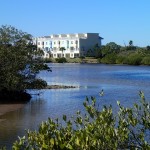
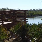
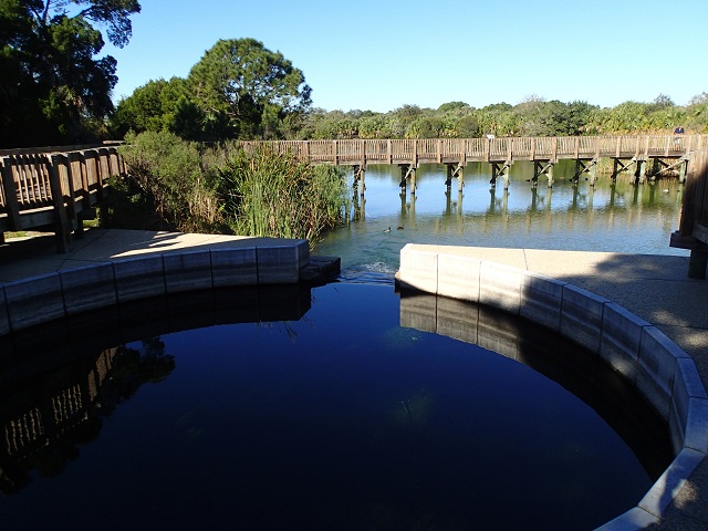
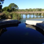
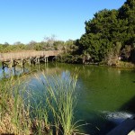
Wall Springs Park, with its spring fed water and views of Boggy Bayou are a highlight. Link follows below this section.
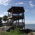
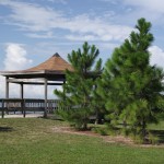
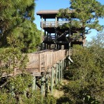
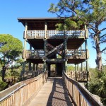
Also in Wall Springs Park, the observation tower offers great views of the surrounding park.
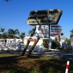
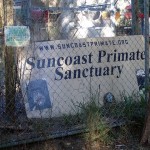
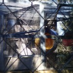
The Suncoast Primate Sanctuary. I was fortunate enough to grab a picture of one of its residents. You can see him (or her) in the upper right corner of the picture in the gallery below (click on the picture to see a larger version). Consider a donation to this worthy organization. There is a link to their website below.
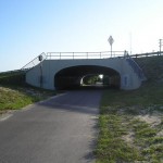
The road underpasses are unique to this area of Florida since the water table is relatively high. Another pro is they finally cleaned out the bats that inhabited the underpasses for a couple of years!
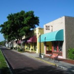
The section through Tarpon Springs is a great spot for stopping for a bite to eat or just to relax.
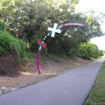
There is quite a bit to see and do along this stretch of the Pinellas Trail. From the eccletic eating experiences in Tarpon Springs, to the wonders of the nature world awaiting at Wall Springs Park, there is something for every cycling level along the Pinellas Trail.