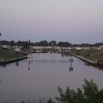
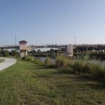
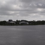
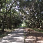
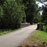
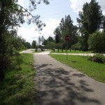
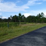
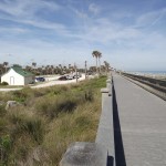
The southern turnabout along the western side of the intercoastal waterway at the Venetian Waterway Park Trail.
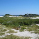
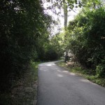
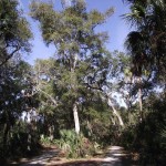
The path to Caspersen Beach at the Venetian Waterway Park Trail.
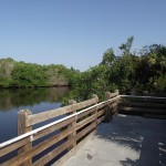
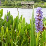
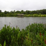
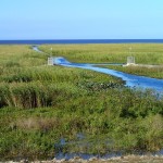
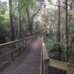
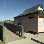
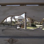
A viewing platform along the Venetian Waterway Park Trail.
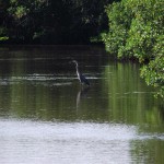
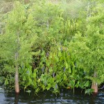
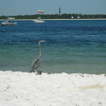
A blue heron wading as seen from the viewing platform along the Venetian Waterway Park Trail.
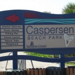
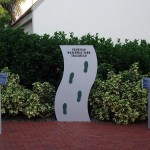
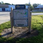
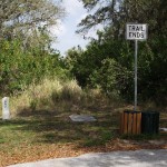
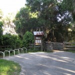
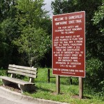
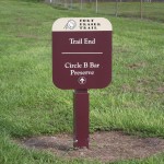
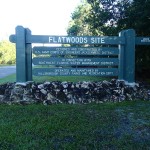
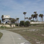
The Caspersen Beach Park sign along the Venetian Waterway Park Trail.
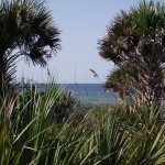
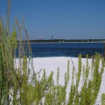
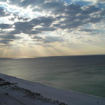
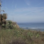
A view of the Gulf of Mexico as seem from the Venetian Waterway Park Trail.
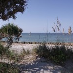
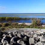
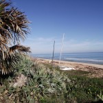
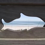
A view of Caspersen Beach from the Venetian Waterway Park Trail
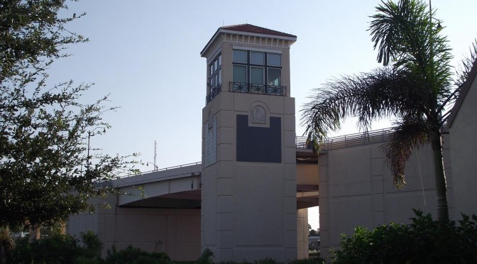
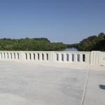
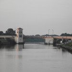
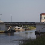
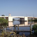
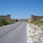
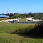
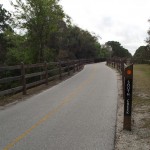
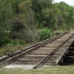
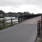
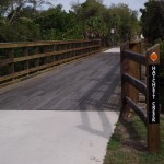
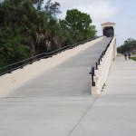
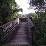
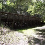
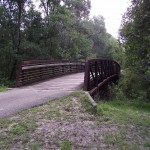
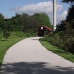
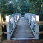
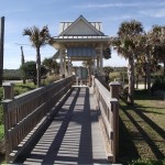
The Caspersen Beach Bridge at the Venetian Waterway Park Trail.
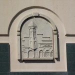
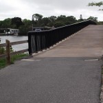
Venice Avenue Bridge Inlay along the Venetian Waterway Park Trail.
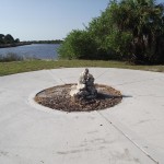
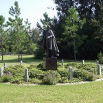
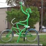
Statue along the Venetian Waterway Park Trail.
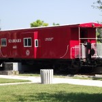
Boxcar along the Venetian Waterway Park Trail.
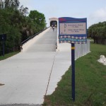
View of boarding platform for the Venice Train Depot at the Venetian Waterway Park Trail.
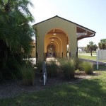
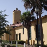
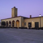
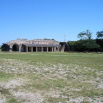
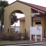
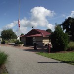
The Venice Train Depot at the Venetian Waterway Park Trail.
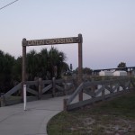
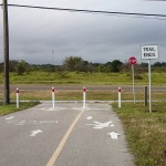
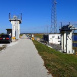
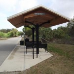
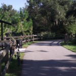
The Venice Train Depot Trailhead at the Venetian Waterway Park Trail.
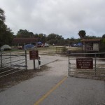
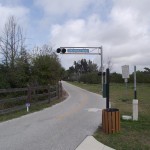
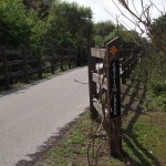
Catlin Crossings at the Venetian Waterway Park Trail.
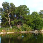
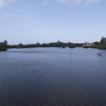
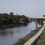
A yacht basin serving a subdivision along the Venetian Waterway Park Trail.
A distant view of the Venice Avenue Bridge as seen from the Venetian Waterway Park Trail.
An osprey surveying its domain along the Venetian Waterway Park Trail.
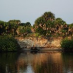
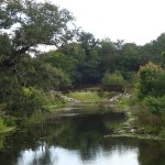
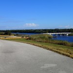
A bluff overlooking the intercoastal waterway as seem from the Venetian Waterway Park Trail.
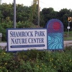
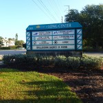
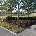
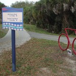
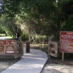
Shamrock Nature Center Sign
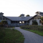
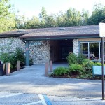
The Shamrock Nature Center in Shamrock Nature Center Park.
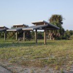
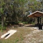
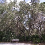
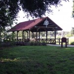
Pavilions in Shamrock Nature Center Park.
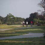
A group of cyclists heading out for a ride from Shamrock Nature Center Park.
Southern most point along the east side of the intercoastal waterway along the Venetian Waterway Park Trail.
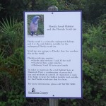
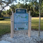
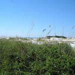
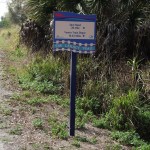
Florida Scrubjay Habitat Sign along Venetian Waterway Park Trail.
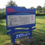
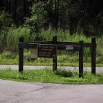
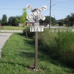
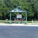
Skip Stasko Park Sign along the Venetian Waterway Park Trail.
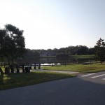
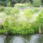
View of Skip Stasko Park as seen from the Venetian Waterway Park Trail.
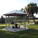
Gazebo at Skip Stasko Park along the Venetian Waterway Park Trail.
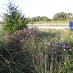
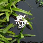
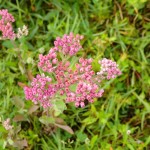
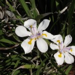
Wildflowers at Skip Stasko park along the Venetian Waterway Park Trail.
Distant view of the Circus Bridge as seen from the Venetian Waterway Park Trail
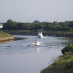
Boats traveling the intercoastal waterway as seen from the Venetian Waterway Park Trail
View of the Venetian Waterway Park Trail from the Circus Bridge.
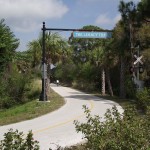
The “Venice Welcomes You” sign along the Venetian Waterway Park Trail
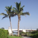
Coconut Palms along the Venetian Waterway Park Trail
Distant view of the Highway 41 Bridge as seen from the Venetian Waterway Park Trail
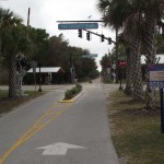
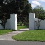
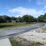
Trailhead in downtown Venice for the Venetian Waterway Park Trail
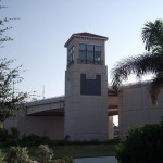
Highway 41 Bridge Tower as seen from the Venetian Waterway Park Trail
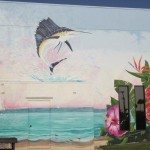
Wall mural along the Venetian Waterway Park Trail
Wall mural along the Venetian Waterway Park Trail
Wall mural along the Venetian Waterway Park Trail
The Circus Bridge along the Venetian Waterway Park Trail
Artwork along the Venetian Waterway Park Trail
Artwork along the Venetian Waterway Park
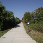
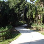
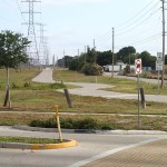
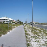
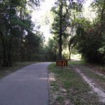
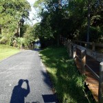
Trail shot along the Venetian Waterway Park Trail
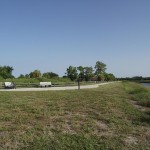
Turnabout along the western side of the intercoastal waterway.
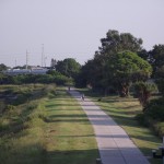
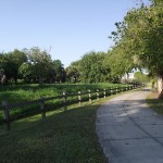
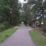
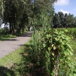
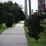
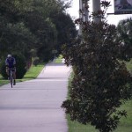
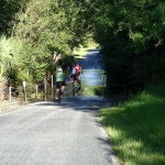
Typical view along the Venetian Waterway Park Trail
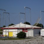
The Circus Arena along the Venetian Waterway Park
Before You Go:
There isn’t a lot of shade along this trail so, if biking during the heat of the day, sunglasses and sunscreen should be used.
If you choose to spend any length of time at Caspersen Beach, remember to bring along a bicycle chain and a beach towel! 🙂
Getting There:
From either north or south on Interstate 75, take Exit 193, Jacaranda Boulevard south to Venice Avenue. Head west on Venice Avenue and exit before the Venice Avenue Bridge. You will see the Venice Train Depot on your right. Park in any designated spot. Alternatively, you can take U.S. Highway 41 either north of south to Venice and head west on Venice Avenue for a short distance. Exiting before the Venice Avenue Bridge.
Trail Length:
The trail length is approximately 22 miles more or less. There are some side trips you can take that will extend the distance traveled.
The Trail:
The trailbed itself is in fairly good shape. The trail is fairly level and flat. For those who do not like bridge crossings, simply riding along the east side of the trail can be sufficient if you add in the Legacy Trail (which is the northern end of the trail just north of the Venice Train Depot).
Facilities:
There are facilities at the Venice Train Depot trailhead.
Facilities can be found at the Shamrock Nature Center.
There are facilities at Caspersen Beach Park.
The Cons:
Other than the lack of shade, there are really no cons along this trail.
The Pros:
The intercoastal waterway.
Caspersen Beach Park along the Gulf of Mexico.
The various art projects along the length of the trail.
This is, other than the bridge to nowhere further north, the only section of the Progress Energy Trail. I have read that there is finally some news on extending the trail, there is budgeting for extending the trail to the north in the 2014 budget.
There is no shade along the trail proper. There is shade at the beginning of the trail that is part of the Ream Wilson Trail. Sunscreen and sunglasses are highly recommended during the afternoon hours.
Getting There:
The starting point of this trail is the same point I started on the Ream Wilson Trail. The link to the post is Ream Wilson Trail Recap.
Trail Length:
This loop is only 7.18 miles. Five miles of the trail is comprised of the Progress Energy Trail. It is about 1.1 miles from the Long Center to the intersection with the Progress Energy trail.
The Trail:
The trailbed is in decent shape. It is nice that they didn’t make the trail arrow straight but, rather, built some curves into the design.
The trail, being so short, can be turned into a longer ride by adding the Ream Wilson Trail (link is above).
Facilities:
There are facilities at Long Center at the start of the trail.
The Cons:
The length of the trail; too short.
There are some very busy streets to cross. Mainly the crossing at Highway 60. Be careful!
The Pros:
The curves built into the design.
Easy access to the Ream Wilson Trail.
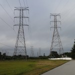
The electrical easement is wide enough that there are opportunities to view minor wildlife along the trail.
There is absolutely no shade on this trail. Make sure to apply sunscreen unless you choose to do this ride in the early morning or late afternoon. Be sure to bring along a helmet since a large portion of the trail is shared with motorized vehicles.
Getting There:
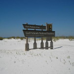
Take Interstate 10 either east or west (depending on your location). Take the Interstate 110 exit south to Pensacola. Take Highway 30/US Highway 98 East and then South across Pensacola Bay. Head south on Highway 399 Pensacola Beach Boulevard. Where Pensacola Beach Boulevard becomes Via Deluna Drive, you will see the parking area for the Pensacola Beach Gulf Pier. This is where I began my ride.
Trail Length:
The trail is 21 miles – from the Pensacola Beach Gulf Pier parking lot out west to Fort Pickens and then looping back to the Pensacola Beach Gulf Pier parking lot..
The Trail:
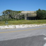
The eastern part of the trail runs along Fort Pickens Road as a separate trail for about 4 miles. At a large parking area, there is a dedicated bike lane the rest of the way to Fort Pickens.
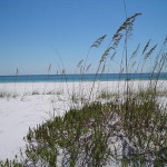
There are many opportunities to head off to the beach front on either the north or south side. Sunglasses are a definite necessity as the sand is extremely white and reflects quite a bit of glare on a sunny day.
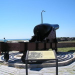
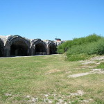
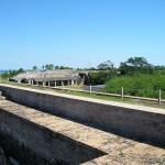
Wading birds abound and be sure to explore the fort grounds.
A beautiful ride in the Florida panhandle. There is a lot to see and do along this pristine stretch of the Florida Gulf Coast.
Facilities:
There are facilities just before the entrance to Fort Pickens proper and then again on the the Fort Pickens grounds.
Facilities are available at the Pensacola Beach Gulf Pier
The Cons:
As you near Fort Pickens, the sand can obscure the shoulder.
Since it is a tourist area, the dedicated trail portion can be frustrated. There are a lot of pedestrians walking the trail that are oblivious to approaching riders.
The Pros:
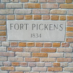
The fort and its history.
Pensacola Bay to the north and the Gulf of Mexico to the south.
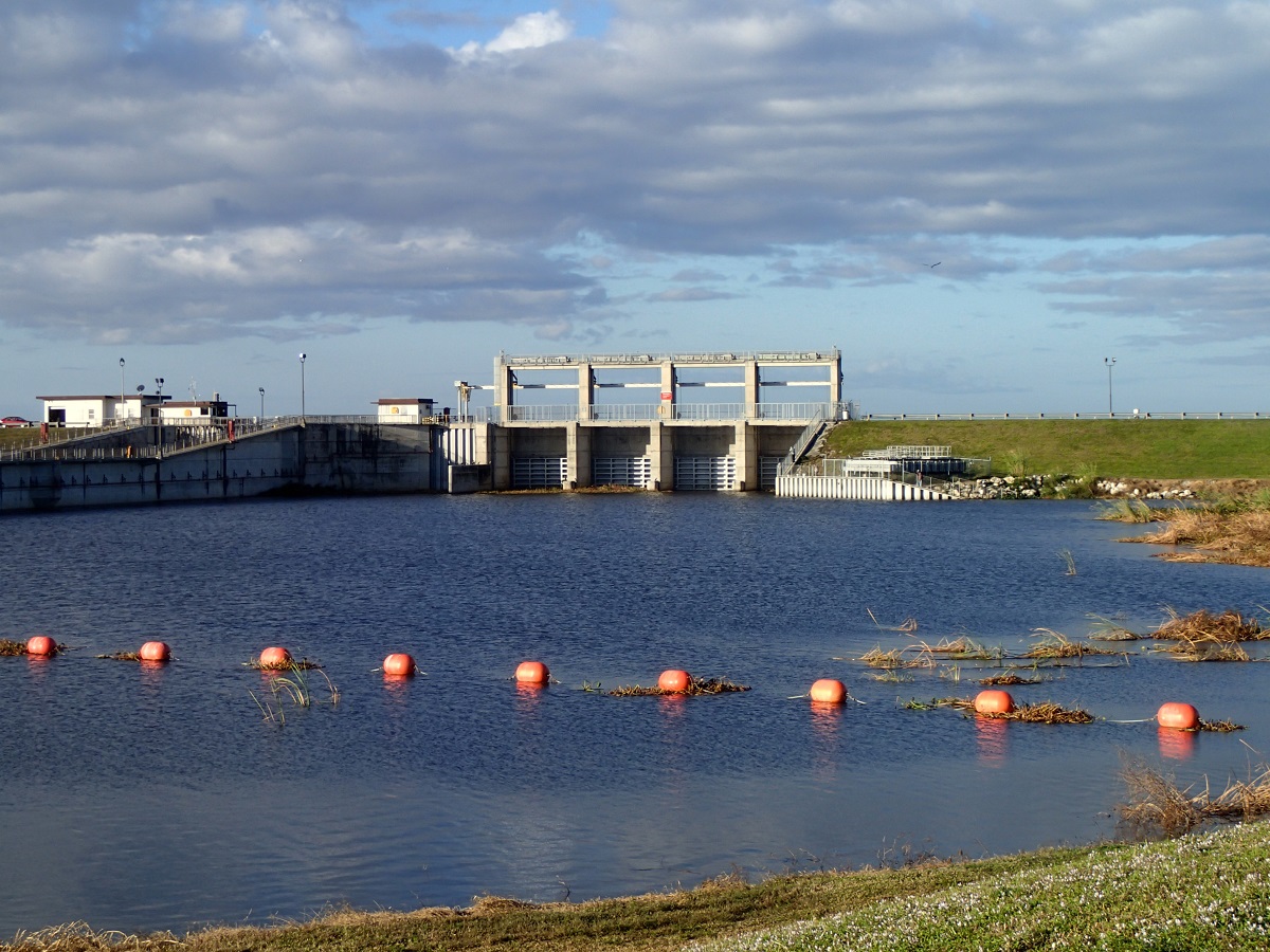
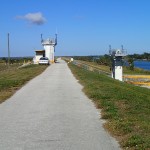
This trail can be tricky. Lake Okeechobee is the 2nd largest fresh water lake in the continental United States. The trail bed is built upon an earthen dike that surrounds the lake. The terrain is relatively flat and the section I rode through was absolutely treeless. Sunscreen is definitely required as well as a good pair of sunglasses. I would also recommend insect repellant. I rode this in November and there were numerous insects.
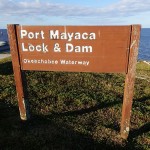
Getting There:
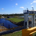
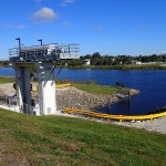
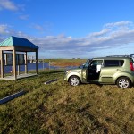
The trail head I chose for this ride was Port Mayaca Locks and Dam. The trailhead is located on the northern side of the lock off U. S. Highway 441/98. Watch for the signs as you approach from either the north or the south.
Trail Length
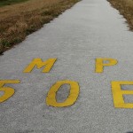
The trail is 29 miles – from the northern side of the Port Mayaca Locks and Dam to mile 50E and back to the Port Mayaca trail head.
The Trail
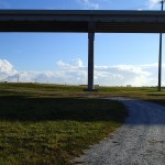
A word of warning to those not familiar with Florida during the summer. There is absolutely no shelter on this trail. It is relatively treeless and you are riding atop a dike surrounding the 2nd largest freshwater lake in the continental United States. Pay attention to the weather forecast and the sky. Lightning strikes, during the summer months, are a reality and you ARE the tallest thing around for miles. You could probably find shelter at one of the locks that you cross every so often.
Second words or warning. Bring insect repellent – even in the dry months. I rode the trail in late November around Thanksgiving and was stung and had to turn back.
Third words of warning, again weather related. Pay attention to the winds and plan accordingly. What might seem an easy ride may be much harder on the return. The winds off Lake Okeechobee are notorious for being persistent and strong. There are no natural wind breaks along the lake.
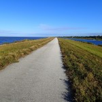
The trail bed itself is in relatively good shape. By the way you cannot circumnavigate the entire lake without venturing on surrounding roads. And, if your goal is to circumnavigate the lake, be aware that the entire trail in not paved. Being spoiled, I only plan to cover the paved portion of the trail.
All in all a fine ride. Do exercise caution crossing Old Highway 50 – it tends to be a fairly busy road and the crossing occurs near a curve in the road.
Facilities:
There are no facilities along this section of the trail. You could, though, venture off the trail at one of the lock crossings and probably find water and restrooms.
The Cons:
The scenery can get monotonous.
No facilities.
You are pretty much alone. The day I rode, I didn’t see anyone else on this portion of the trail. Make sure to bring your cell!
The Pros:
Lots of opportunity to watch wading birds along the shoreline.
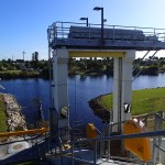
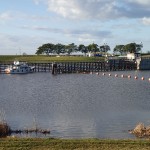
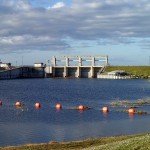
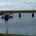
The Port Mayaka locks. It is interesting to watch boats navigating through the lock.
Just a note that I had to switch over to a new plugin for my trail maps. It seems that GPSIES.Com is DOA. If you are riding early or later in the day, you can get by without sunscreen. Any other time of day, you will definitely want to protect yourself from the sun. The normal equipment is recommended – helmet, gloves, sunglasses.
Getting There:
I started my ride at the McIntosh Road trailhead. From either the north or the south, take exit 305 off of Interstate 75 and head west on Clark Road (Highway 72) to Honore Avenue. Head south on Honore Avenue to Palmer Ranch Parkway. Head west on Palmer Ranch Parkway to its end at McIntosh Road. Head south on McIntosh road and watch for the signs marking the location of the trailhead.
Trail Length
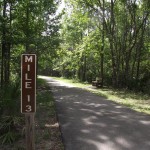
The trail 22 miles. From the McIntosh Trailhead south to the Venice Train Station then looping back north to the northern terminus of the trail and back to the McIntosh Trailhead..
The Trail
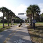
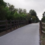
The Legacy Trail is not a very old trail so the trail bed is in fairly good shape. Like most rail to trail projects, the trail is fairly arrow-straight; it runs in a southeast to northwest direction.
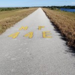
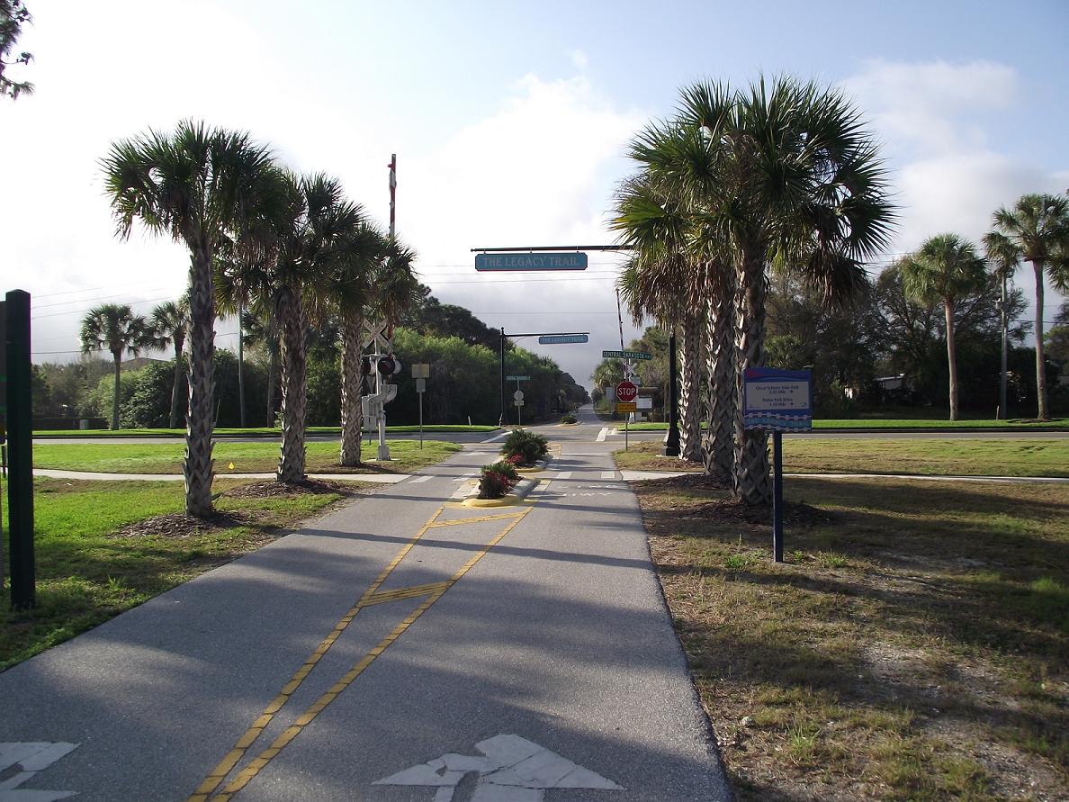
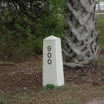
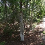
In case you wonder, the concrete markers with the numbers on them are in the style that, in the past, marked the distance from the northern terminus of the railroad in Richmond, Virginia.
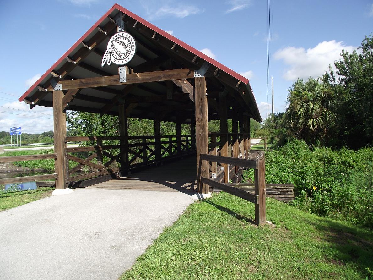
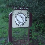
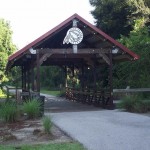
Near Oscar Scherer State Park entrance, stop and enjoy the old railroad trestle that is preserved along the western side of the trail.
Check out the links and pictures below.
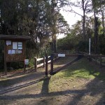
Facilities:
There are facilities at the Venice Station.
There are various covered “stations” along the trail to rest and enjoy a snack or some water.
The Cons:
Some may find the arrow-straight direction of the trail monotonous or tedious.
This is an urban trail so there are quite a few street crossings. Especially along the southern 1/2 of the trail.
There is a lot of shade along the trail. 85% of the trail is tree lined on both sides so you could probably get by without sunscreen. The western end of the trail is fairly hilly.
Getting There:
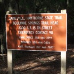
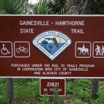
I chose to start my adventure from the Hawthorne end of the trail. There is plenty of parking and the trailhead is much less used than its counterpart Boulware Springs Trailhead in Gainesville. Either traveling north or south on U.S. Highway 301 to the town of Hawthorne, travel west on West Lake Avenue, head south on North Johnson Street, turn west on 71st Avenue and, finally, turn south on Southwest 3rd Street. Southwest 3rd Street dead-ends into the trailhead parking.
Trail Length
Just shy of 32 miles. A loop from the Hawthorne Trailhead to the Boulware Springs Trailhead and back to Hawthorne.
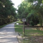
The Trail
The trail bed is showing signs of wear. Mainly due to tree roots growing under the trail-bed. As you approach Gainesville, you will right through the hills and curves section of the trail. It should prove an excellent challenge to coastal riders who are used to the relatively flat and straight corridors. That is another one of the reasons I chose to ride from the Hawthorne Trailhead. I didn’t want to start and end a session but, rather, preferred to make the hilly section part of the middle of the ride.
Check out the links and pictures below.
Facilities:
I only noticed 1 area with a restroom along the route. Unfortunately, I didn’t make note of its location but it appears along the south side of the trail closer to the Gainesville trailhead.
The Cons:
Those that find hills taxing will likely view the hills as a con rather than a pro 🙂
Some cyclists, in the hills and curves section, were not mindful of cyclists traveling in the opposite direction. There are limited site lines along this portion of the trail. Cycle pro-actively.
There are a few sections of the trail-bed that are a little rough in spots as you near Gainesville.
The Pros:
The hills I mentioned above.
There are curves built into the trail which is a nice change from the mostly arrow-straight trails that abound in Florida.
The cutoff to the overlook of Lake Alachua (not actually a lake – more a savannah or prairie).
There are a lot of open areas along the trail so, if you are biking during the heat of the day, sunscreen and sunglasses are recommended. Also, there are some rises in elevation if you are sensitive to small climbs.
Getting There:
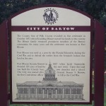
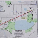
From Interstate 4 either east or west, take exit 32 (Highway 35/U.S. 98) south (North Florida Avenue). Head east on Bartow Road (Highway 35/U.S. 98/County Road 548). The road will take a turn to the south and east. There is parking at the University of South Florida in Lakeland campus. Further south, head east on Hancock Avenue SE and take 4th Street SE to the northwest. The trailhead is on the west side of 4th Street SE.
Trail Length
15.5 Miles – A loop out and back from either of the spots mentioned above.
The Trail
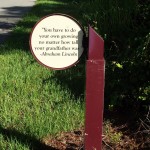
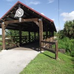
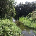
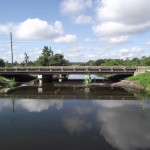
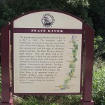
The trail bed is in excellent shape. It is relatively straight and follows a power utility easement parallel to U.S. Highway 98 (Bartow Road). If there has been recent rains, the crossing at the Peace River can be pretty (looking away from U.S. 98). An interesting feature of this trail are the inspirational signs that appear along the way.
Facilities:
The main trailhead at 4th Street SE.
The Cons:
The straight nature of the trail. Some may find it monotonous.
Depending upon your tolerance for small rises in terrain, the northern end may be a struggle for the casual cyclist.
Busy and noisy U.S. Highway 98 runs the length of the trail.
The Pros:
The trail bed is in excellent shape.
There are a few rises and dips along the northern end of the trail. A nice change from the normal flat trails along coastal Florida.
There is a mix of sun and shade along this trail. If you just do a single loop and are riding in the early morning and early evening, you should be fine without sunscreen. During the rainy summer months, insect repellant is strongly recommended. Just stopping to snap some pictures and I was swarmed by mosquitoes. Also, there is a fee to use the park. It is on the honor system and the fee is currently $2.00. Bring cash (or a pen to write an IOU *smile*).
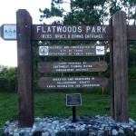
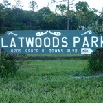
Getting There:
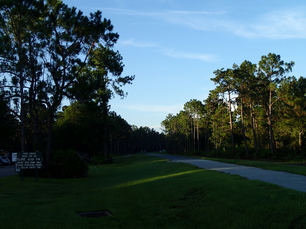
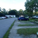
From either north or south on Interstate 75, take exit 270, Bruce B Downs Boulevard. The trailhead will be about a mile east on the south side of Bruce B. Downs Boulevard.
Note: I am trying a new plugin for generating my GPX files. Hope you like it better than the previous plugin.
Trail Length
14.2 Miles – From the Bruce B. Downs Trailhead out to the Morris Bridge Road entrance and back to Bruce B. Downs Trailhead. It also includes the short spur to the east when returning for Morris Bridge Road just before the pylons prohibiting motorized traffic.
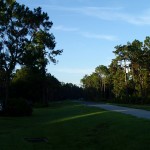
The Trail
The trail bed is in excellent shape. During the rainy season, the dip in the trail near the Hillsborough River can be flooded. There is a bridge cut around that you can use. Please be courteous since the bridge is narrow and there isn’t enough for cycling across the bridge. It would be safer for all involved if you walk your bike if using the cut around.
Facilities:
There are facilities at the Bruce B. Downs trailhead.
There are facilities at the Main Entrance at Morris Bridge Road
There are several spots along the trail with fresh water and they seem to keep the water stocked throughout the day.
The Cons:
There are a lot of casual bikers and joggers throughout the park. Some of them don’t seem aware of approaching cyclists.
The trail is a little on the short side.
If you have never been to the trail, and since a lot of people don’t carry cash any more, the $2.00 fee can be a problem. There doesn’t seem to be an alternative payment option.
The Pros:
The trail bed is in excellent shape.
Nice pine uplands and scrub habitat
In the rainy season, Trout Creek flowing across the trail bed.
Warning: Use of undefined constant name - assumed 'name' (this will throw an Error in a future version of PHP) in /home/viewfr7/public_html/wp-content/plugins/osm/osm_map/osm-oljs2.php on line 751
Warning: Use of undefined constant width - assumed 'width' (this will throw an Error in a future version of PHP) in /home/viewfr7/public_html/wp-content/plugins/osm/osm_map/osm-oljs2.php on line 751
Warning: Use of undefined constant height - assumed 'height' (this will throw an Error in a future version of PHP) in /home/viewfr7/public_html/wp-content/plugins/osm/osm_map/osm-oljs2.php on line 751
Warning: Use of undefined constant offset_width - assumed 'offset_width' (this will throw an Error in a future version of PHP) in /home/viewfr7/public_html/wp-content/plugins/osm/osm_map/osm-oljs2.php on line 751
Warning: Use of undefined constant offset_height - assumed 'offset_height' (this will throw an Error in a future version of PHP) in /home/viewfr7/public_html/wp-content/plugins/osm/osm_map/osm-oljs2.php on line 751
Warning: Use of undefined constant Marker - assumed 'Marker' (this will throw an Error in a future version of PHP) in /home/viewfr7/public_html/wp-content/plugins/osm/osm_map/osm-oljs2.php on line 782
Warning: Use of undefined constant name - assumed 'name' (this will throw an Error in a future version of PHP) in /home/viewfr7/public_html/wp-content/plugins/osm/osm_map/osm-oljs2.php on line 794
Warning: Use of undefined constant width - assumed 'width' (this will throw an Error in a future version of PHP) in /home/viewfr7/public_html/wp-content/plugins/osm/osm_map/osm-oljs2.php on line 798
Warning: Use of undefined constant height - assumed 'height' (this will throw an Error in a future version of PHP) in /home/viewfr7/public_html/wp-content/plugins/osm/osm_map/osm-oljs2.php on line 798
Warning: Use of undefined constant offset_width - assumed 'offset_width' (this will throw an Error in a future version of PHP) in /home/viewfr7/public_html/wp-content/plugins/osm/osm_map/osm-oljs2.php on line 799
Warning: Use of undefined constant offset_height - assumed 'offset_height' (this will throw an Error in a future version of PHP) in /home/viewfr7/public_html/wp-content/plugins/osm/osm_map/osm-oljs2.php on line 799
Warning: Use of undefined constant text - assumed 'text' (this will throw an Error in a future version of PHP) in /home/viewfr7/public_html/wp-content/plugins/osm/osm_map/osm-oljs2.php on line 807
Warning: Use of undefined constant lon - assumed 'lon' (this will throw an Error in a future version of PHP) in /home/viewfr7/public_html/wp-content/plugins/osm/osm_map/osm-oljs2.php on line 809
Warning: Use of undefined constant lat - assumed 'lat' (this will throw an Error in a future version of PHP) in /home/viewfr7/public_html/wp-content/plugins/osm/osm_map/osm-oljs2.php on line 809
Warning: Use of undefined constant popup_width - assumed 'popup_width' (this will throw an Error in a future version of PHP) in /home/viewfr7/public_html/wp-content/plugins/osm/osm_map/osm-oljs2.php on line 813
Warning: Use of undefined constant popup_height - assumed 'popup_height' (this will throw an Error in a future version of PHP) in /home/viewfr7/public_html/wp-content/plugins/osm/osm_map/osm-oljs2.php on line 813
Before You Go:
Except for a couple of miles of wooded area in the northern section of this trail, there is virtually no shade along the trail. If not riding in the early morning or early evening, sunscreen and sunglasses are definitely recommended. There are not a lot of opportunities for fresh water along the trail so carry some along to stay hydrated.
Getting There:
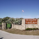
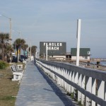
Getting there is fairly simple. Take either Interstate 95 North or South and proceed to Exit 284 which is Highway 100 (East Moody Boulevard). Head east to the waterfront. There is free parking at the Flagler Beach Pier. I didn’t see any signs limiting the duration of parking but things do change so be aware of any posted signs regarding parking or metering.
Trail Length
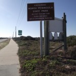
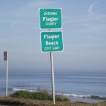
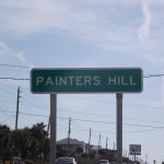
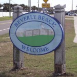
38.2 Miles – From the Flagler Beach Pier, south to the Flagler County Line, north through Flagler Beach, Beverly Beach and Painters Hill to the southern outskirts of Marineland. Heading back south from Marineland and arriving back at the point of origin at the Flagler Beach Pier.
The Trail
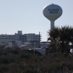
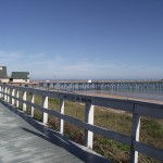
For much of the trail’s length, the Atlantic Ocean is to your east. Unlike the Pinellas County coast (where I live), the Flagler County coastline is not lined, wall to wall, with high-rise hotels, condominiums and timeshares. The coast has long stretches of undeveloped coastline.
This trail is much longer than the normal trail (or trail sections) that I recap. It is a flat course and the trailbed is in relatively good shape. There can be congestion around more populated areas such as Flagler Beach. Exercise caution as it seemed most people walking on the trail were oblivious to bikes sharing their space.
Facilities:
There are facilities at the Flagler Pier.
There are facilities at the welcome center for Gamble Rogers Memorial State Recreation Center (across from the main entrance).
There are facilities at Varn Park (where the trail crosses over to the east side of Ocean Shore Boulevard).
There are facilities where the trail currently ends at the Marineland City Limit.
The Cons:
Very little shade.
The constant traffic along 1A (North Ocean Shore Boulevard).